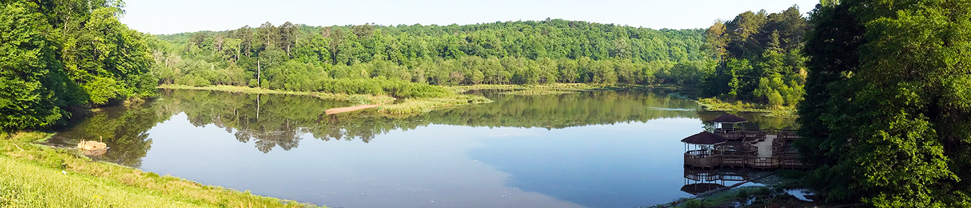
A Day in the Life at Chicopee Lake
Editor’s Note: Don Lane, Elachee Teaching Naturalist and retired environmental scientist will provide insight, each month throughout 2022, about different environs and species in, and around Chicopee Lake, located in Georgia’s Chicopee Woods Nature Preserve, in south Hall County.
Don Lane’s Journal Entry: May 2022
Pond/Lake Succession: Chicopee Lake through the Years
If you have visited the lake over the course of a few years, you may have noticed it is getting smaller. That is, the area of open water is decreasing. It is, and here is why.
Lakes and ponds (whether natural or man-made) go through a succession. Succession is a natural process by which a pond/lake changes over time.
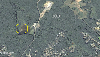
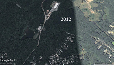
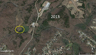
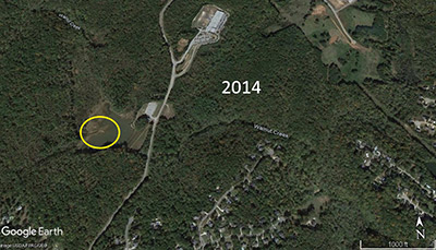
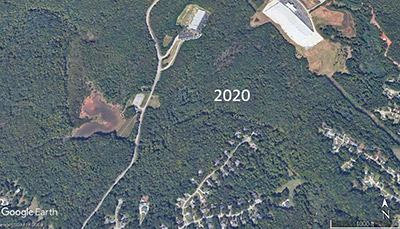
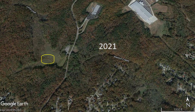
As Walnut Creek flows in a generally southward direction, it picks up sediment. The water velocity in Walnut Creek is sufficiently fast enough to allow many of the sediment particles to ‘defy gravity,’ and not fall to the streambed. However, when the fast-flowing water of Walnut Creek encounters the still water of Chicopee Lake gravity takes over. The heavier-than-water sediment particles drop and begin to settle at the bottom of the lake. This is the mechanism that contributes to pond/lake succession.
The accepted model of pond/lake succession is: Pond/Lake >> Marsh >> Dryland/Grasses >> Shrubs >> Forest.
How fast this happens is dependent on two things: the rate of sedimentation and human intervention. For instance, if there is a lot of land disturbance upstream and proper sedimentation controls are not used, then more sediment than normal can reach the lake. Thus, speeding succession.
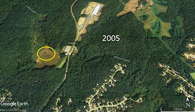
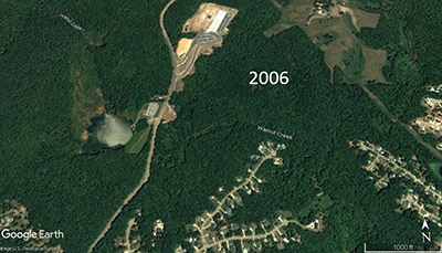
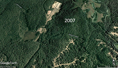
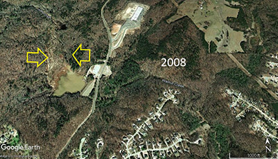
Humans can extend the life of a pond or lake by dredging. Dredging removes the bottom sediments allowing for more water in the pond/lake. Dredging is expensive and comes with the big problem of what to do with the dredged material. Chicopee Lake was last dredged in September of 2007.
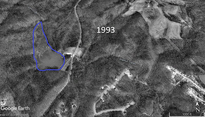
According to lakesonline.com, which appears to get its information from the National Inventory of Dams, the dam was constructed in 1973 with a stated purpose of flood control. The owner of the dam is listed as the Upper Chattahoochee Soil and Water Conservation District. The surface area of the lake (the area of open water) was to be 20 acres. The current area of open water is estimated to be 8 acres.
Without human intervention, Chicopee Lake will continue its successional journey to forest. How long will this take? There are many complex factors involved such as extremely dry or extremely wet seasons, land disturbance upstream, human intervention such as dredging, and others. However, based on my analysis of sedimentation rates, Chicopee Lake could be dry land by 2047.
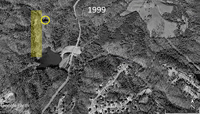
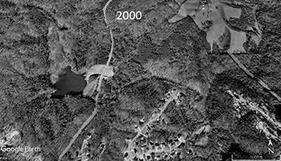
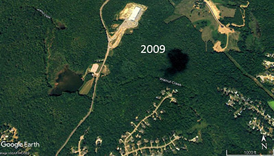
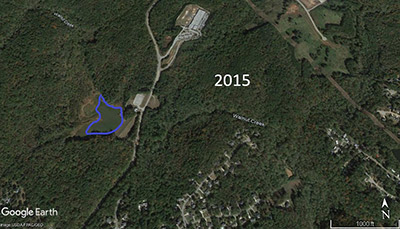
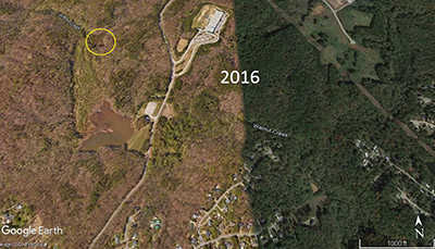
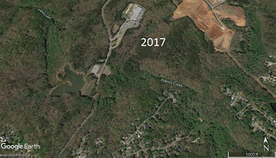
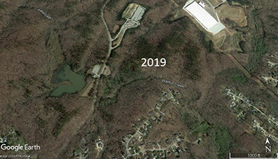
Google Earth can be a useful tool to understand how an area changes over time using satellite images. The following set of pictures depict Chicopee Lake from 1993 to 2021.